
Planty Park
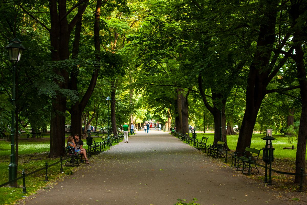
Planty is a 4-kilometre ring around Kraków’s Old Town, 20.51 hectares, and from 40 to 120 metres wide. The greenery office splits it into eight gardens named for the Barbican, the station, Florianka, Gródek, the Palace of Art, Stradom, the University and Wawel. The paths sit on the line of the demolished city walls.
A belt where the walls came down
The municipal greenery office places Planty in District I, a park around the Old Town, closed by a ring of streets: Westerplatte, św. Gertrudy, Podzamcze, Straszewskiego, Podwale, Dunajewskiego and Basztowa. It calls Planty the oldest of the city’s garden parks, and one of the largest. The measured belt is 4 kilometres long and between 40 and 120 metres wide, on 20.51 hectares. A 2012 city page still in the municipal service gives the same length and rounds the area to about 21 hectares, and it counts about 40 species of trees and shrubs.
The word the greenery office uses is for ground laid out where fortifications or old river corridors were removed. The city page says the Austrian authorities began taking down the walls at the start of the 19th century, kept a short stretch around the Barbican and St Florian’s Gate, and in 1822–1830 made a city garden on the rest. It names Feliks Radwański the Elder as the creator, helped by his son, also Feliks. The greenery office’s life of Florian Straszewski starts earlier: he moved to Kraków in 1817, and in 1818, with Radwański senior, laid out a first piece of the later Planty near Plac Szczepański. That page says the official setting-out began in 1820, when Straszewski joined the Economic Committee. In 1821–1822 he and Paweł Florkiewicz drew the plans for levelling the ground, draining and filling the holes and the moat, planting the levelled ground, and marking avenues. He paid labourers himself. In 1822 he founded the Committee for the Beautification of Kraków.
The same life says that after 1826 he extended Planty around Wawel Hill, with vineyards and peach orchards on the southern slopes. The Austrian army destroyed those after 1848, when Wawel was turned into a citadel and barracks. In the 1830s he gave the ring the shape of a city park around the whole Old Town. The office dates the end of the planting works to 1838, when the Senate of the Free City of Kraków ordered a medal for him, designed by Józef Dan Böhm, with the inscription to Florian Straszewski for his sacrifice and toil in beautifying the city, from the Senate and the people of Kraków. He died on 2 March 1847 in his flat on ul. Bracka. The city page puts a later piece of the ring at about 1880, between the Barbican and the outlet of ul. Sławkowska, until then part of the Kleparz market, and it dates Straszewski’s own foundation for upkeep to 1830, with his son Maurycy in a similar role afterwards.
Eight gardens, two playgrounds, a line of monuments
The eight gardens take their names from what stands beside them: Barbakan, Dworzec, Florianka, Gródek, Pałac Sztuki, Stradom, Uniwersytet and Wawel. The greenery office lists flower beds, ponds, bridges, and two playgrounds: Plantuś on ul. Poselska, and Dzikie Planty on ul. Św. Gertrudy. Named objects on that page are the Lantern of the Dead, the Freedom Tree, and the Chopin piano fountain. The monuments it names are Michał Bałucki, the bard Bojan, Jadwiga and Jagiełło, Lilla Weneda, Artur Grottger, Nicolaus Copernicus, Grażyna and Litawor, and Tadeusz Boy-Żeleński. The city page says the first obelisk, put up opposite the railway station in 1874, commemorates Florian Straszewski, and it groups Lilla Weneda, Grażyna and Bohdan Zaleski as the Bojan group. A 2012 note on that page calls a plane at the outlet of ul. Wiślna a natural monument and gives its age then as 130 years.
The greenery office says the ring is on the UNESCO World Heritage List. It also points to a field game in the app Kraków w zieleni, “Planty yesterday and today – the Wawel Garden,” walked on the existing paths. That garden is two enclaves, one by the Franciscans and one by the seminary. The city page adds an older layer of the paths: gas lamps, a pond, and from the 1890s wooden kiosks selling Rząca-Chmurski soda water. About 1930 the firm built three brick kiosks that it says are still there, at the outlets of ul. Szewska and ul. Sławkowska and beside the Słowacki Theatre, where the city information point now is. Restoration, on that page, started in 1988, putting back the composition of the sections, the lamps, the fence the occupiers had taken down, and the small architecture.
FAQ
Which stop is actually on the ring?
The greenery office lists Teatr Słowackiego, Dworzec Główny Zachód, Poczta Główna, Stary Kleparz, Teatr Bagatela, Filharmonia, Plac Wszystkich Świętych, Wawel, Św. Gertrudy and Stradom. It does not print a tram or bus line number. The streets that close the park are Westerplatte, św. Gertrudy, Podzamcze, Straszewskiego, Podwale, Dunajewskiego and Basztowa.
When was the garden actually started?
The city page says the garden was laid out in 1822–1830 and names Feliks Radwański the Elder as its creator. The greenery office says a first fragment near Plac Szczepański was made in 1818, that official setting-out began in 1820, and that the planting works ended in 1838. The latest section on the city page, between the Barbican and ul. Sławkowska, is dated about 1880.
Where are the playgrounds?
Plantuś is on ul. Poselska. Dzikie Planty is on ul. Św. Gertrudy. Those are the two play areas the greenery office names. The Wawel Garden field game in the app Kraków w zieleni uses the paths of two enclaves, one by the Franciscans and one by the seminary.